Yoosys is a technology driven emerging GIS services & spatial data provider for creative solutions in the areas of Geo-referencing, Cadastral Mapping, Image Processing / Orthophoto, Basemap Classification & Urban Planning.
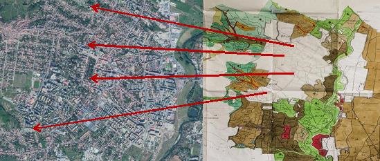
Geo-referencing is a process of locating an entity in real world coordinates. It aligns geographic data to a known coordinate system representing earth defined through projection systems so it can be viewed, queried, and analyzed with other geographic data.
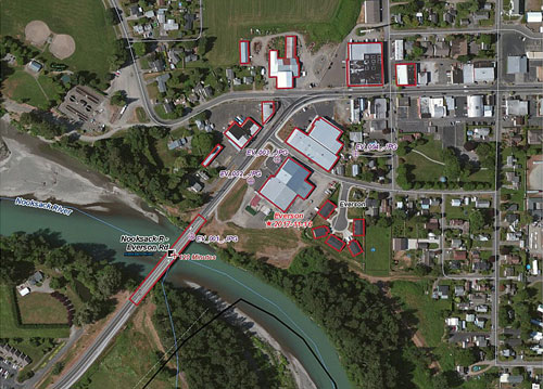
To Geo-referencing a geographic data, the positions of known points, called control points, are determined. The Ground Control Points (GCPs) are defined as the points with known Geo- referencing l location, whose positions on map correspond to their positions on earth. GCPs are collected from fixed objects and are marked on the data to be Geo-referencing that define where the data is on earth. The whole data adjusts itself according to these GCPs. At least three control points are required for Geo-referencing a data. Additional control points help increasing the accuracy. Once the data is Geo-referencing, each point has a coordinate associated to it which means the location of any object in the data (map) can now be determined.
Yoosys has capable of Geo-reference of raster maps, satellite Imageries, and other vector data which doesn't had co-ordinate system in hues quantity.
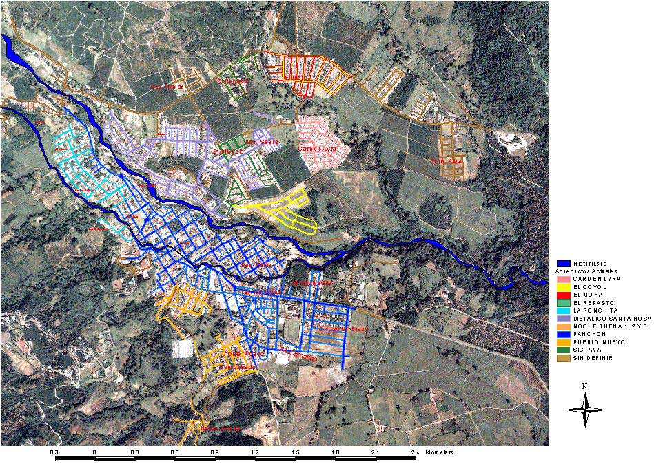
Cadastral mapping is the method of registering land, designed to ensure the rights of individuals and the state of their property. Every activity in general, and developmental project activity in particular, is in some form or the other associated with land. Therefore, for planning purpose all land-associated information should be available in the form of a computer database, which can be easily accessed, manipulated by decision makers while formulating and executing a work. Such a database system is called Land information system. Cadastral applications will include cadastral index maps and land registration data in a digital format. Automation linkages will be created and developed between textual data (legal land registration data) and parcel maps. The final goal is to generate digital maps which will facilitate land management and planning and in particular land registration and the issuance of land titles in order to promote security of land tenure and reduce land disputes. Therefore land administration systems are not 'just handling only geographic information' as they represent a lawfully meaningful relationship amongst people, between people and land.
Our services include scanning, Digitization & indexing of digital data. We take care of each aspect to preserve the originality of the document. Yoosys also provide solutions such as with joining of RoR data with land parcels.
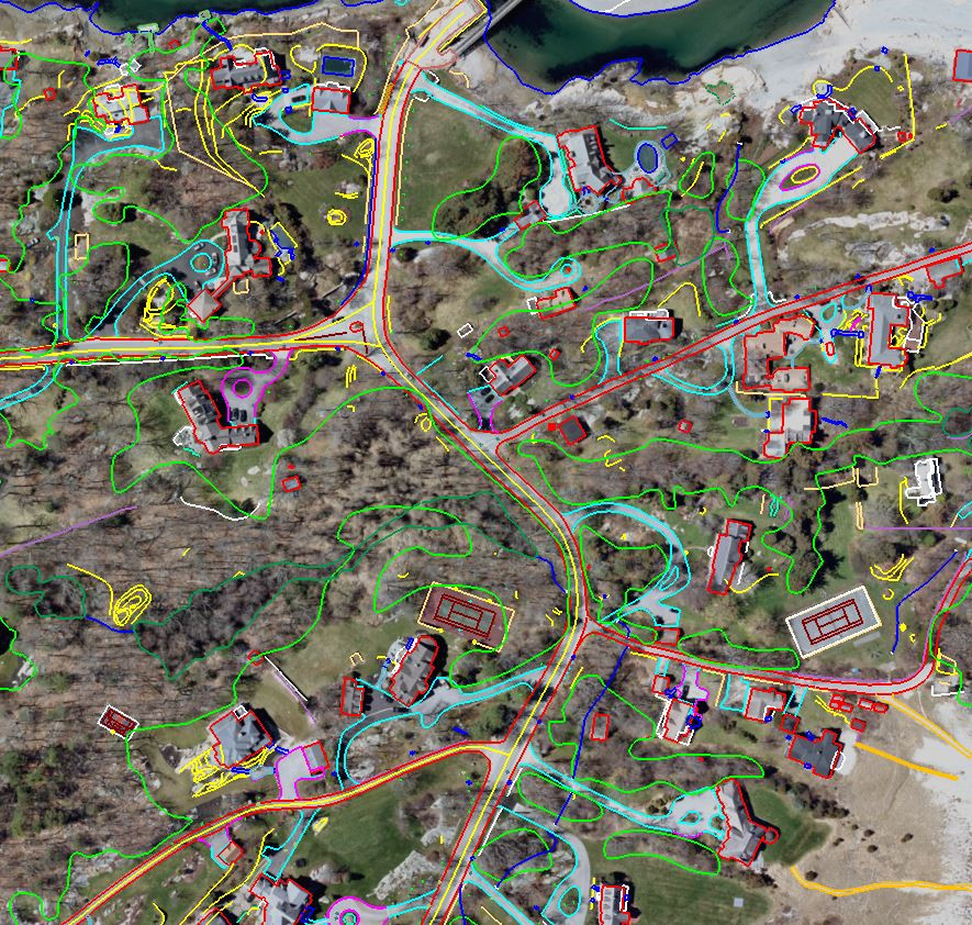
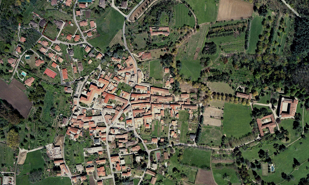
An Orthophoto is an aerial photograph geometrically corrected ("orthorectified") such that the scale is uniform: the photo has the same lack of distortion as a map. Orthophotographs are commonly used in the creation of a Geographic Information System (GIS). Unlike an uncorrected aerial photograph, an orthophotograph can be used to measure true distances, because it is an accurate representation of the Earth's surface, having been adjusted for topographic relief, lens distortion, and camera tilt.
Yoosys generates Orthophoto at our facility centre with very good resolution and tone, with image enhancement and edge sharpening which is a result of special Image Processing techniques. The process also involves color / contrast matching and feathering techniques to ensure a virtually seamless mosaic. Yoosys technician's knowledge of principles and practices in Orthophotography is complemented with the use of all industry standards.
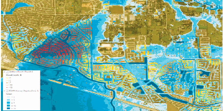
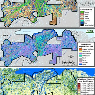
Most choropleth maps (and graduated symbol maps) employ some method of data classification. The point of classification is to take a large number of observations and group them into data ranges or classes. Why? Map readers often find a few well-defined classes are easier to understand than raw data since, if done well, they help to simplify and clarify the message of the map. Data classification, however, is not without some challenges and it is often difficult to find an "ideal" method for a given dataset. It is always wise to have an understanding of the data you are working with before blindly applying a "favorite" classification method, which may create false patterns on your map that bear little resemblance to the actual geographic phenomena you are trying to portray. Maps that use questionable classification methods are more than ineffective; they're misleading.
Classification matters because how we group our data into classes is one of the most fundamental aspects of map generalization-the process by which we simplify the real world to fit it on to the page-and small differences in how we do that can dramatically change the look of the map, and thus, its message. Despite this influence, data classification is often taken for granted by map readers since we rarely notice or question the classes that are used in maps, and thus, it is one of the easiest ways to "lie with maps" -whether intentionally or accidentally. Nonetheless, classification is a useful and basic part of making thematic maps.
At Yoosys, we offer cutting-edge Urban Planning services powered by GIS (Geographic Information Systems) technology to help cities and urban regions thrive with sustainable and smart development. Our team of skilled urban planners and GIS experts combine data-driven insights with innovative spatial analysis to create well-designed, efficient, and livable urban environments.
1. Comprehensive Data Integration
2. Spatial Analysis and Modeling
3. Zoning and Land Use Planning
4. Infrastructure Planning
5. Visualization and Communication
At Yoosys, our Urban Planning in GIS service is designed to transform cities and urban regions into vibrant, inclusive, and sustainable places to live, work, and play. Partner with us to unlock the full potential of your urban area and make your city a model of efficient and forward-thinking development.

